Help! I'm lost!
Signage
Prof. Santo Romano
2013
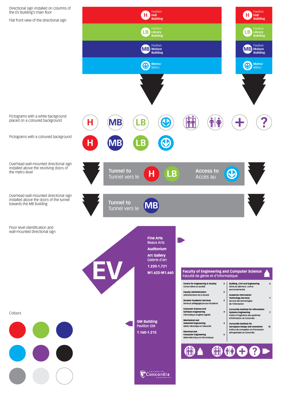
We were asked to create a wayfinding design for a school, hospital or airport. For this project, I chose my school as the place where I wanted to improve the wayfinding system.
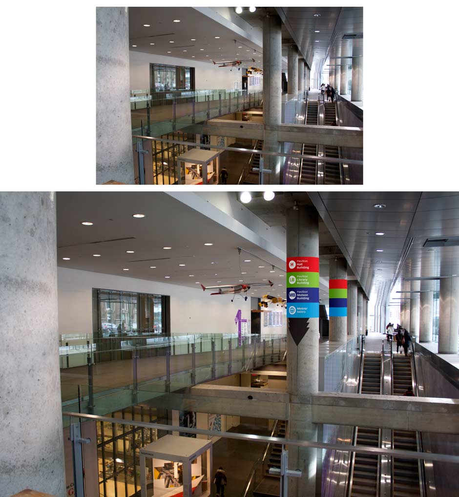
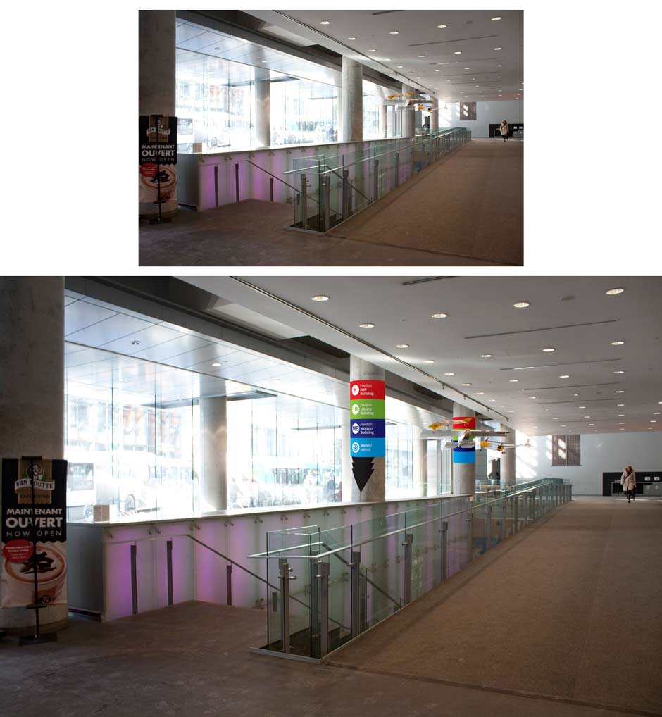
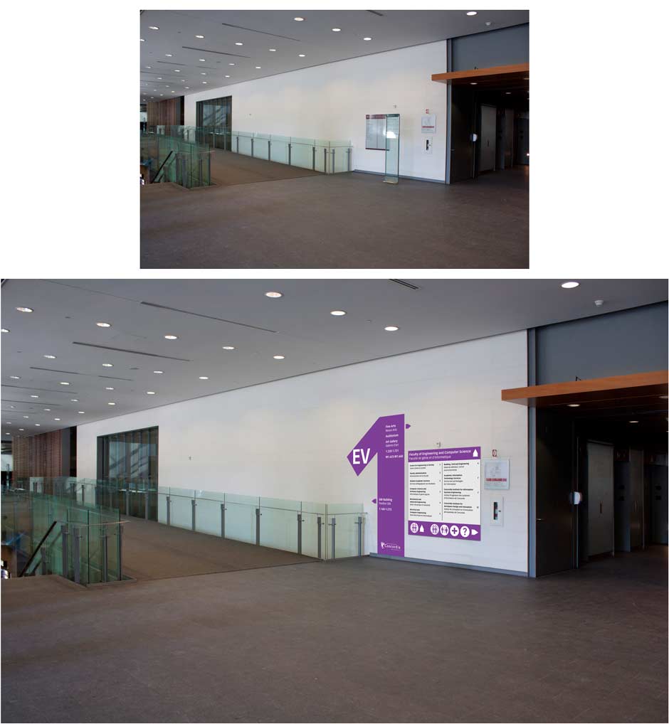
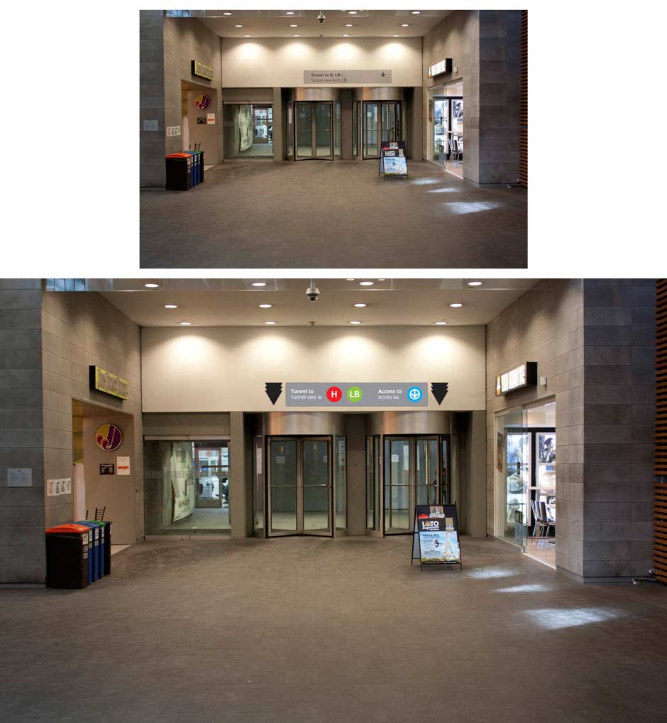
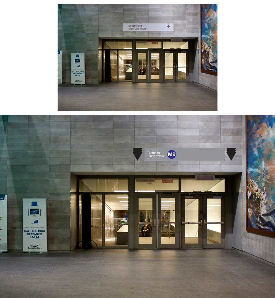
After observing how and where people would walk on the main floor to head towards the underground tunnel or metro, I decided to add some signage to make it clearer for not only the students or employees of Concordia, but also the public. I noticed before that a lot of people walked through Concordia to access the Sainte-Catherine Street or the side entrance of the EV building and vice versa. I chose this location as some people asked me how they could access the metro from the main floor.
Since the metro is connected to the school and some people had issues figuring out where it was, I added the metro symbol on the signage to show where it is. The metro symbol on the current signage is too small for people to notice. Furthermore, since there is no indication telling people what does H or LB or MB mean except for those who look at the map situated at the main entrance of the EV building, I added on the signage I created for the concrete columns the meaning of each. A person will then follow the indications to arrive at the right destination. I applied here the concept of districts to Concordia by using different colours to identify each building.